Malinô Brdo is located only 1 km from the center of Ružomberok. It is located in the beautiful environment of Veľká Fatra at an altitude of 545 to 1209 m.a.s.l. It is a popular resting place not only for domestic but also foreign tourists.
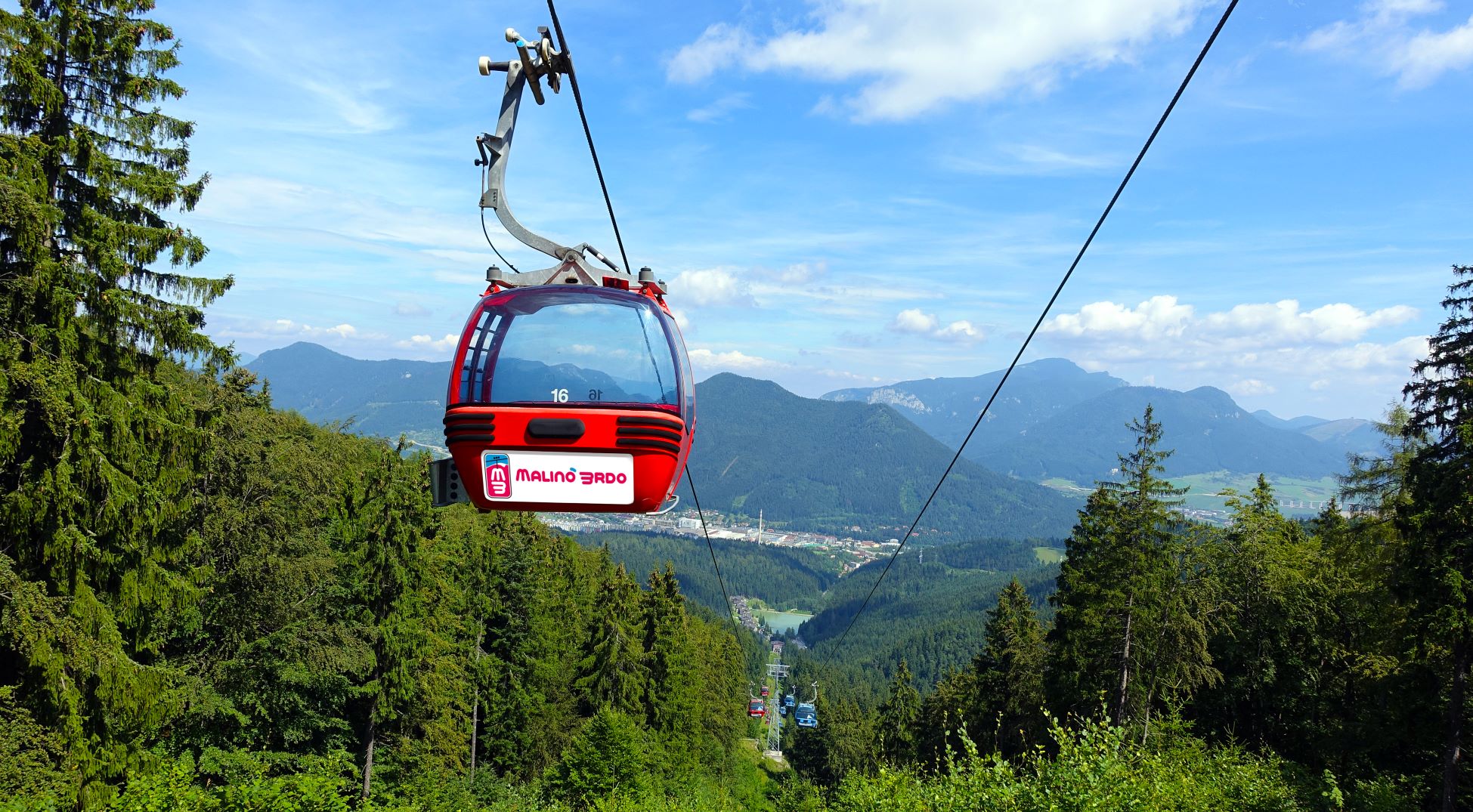
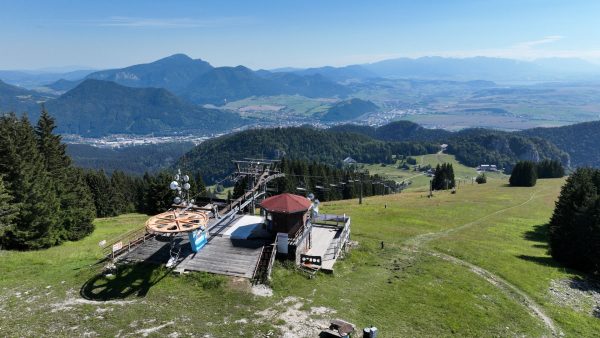
A chair lift takes visitors to the top of Malinné (1 209 m above sea level), from where they can enjoy panoramic views of the Western, Low and High Tatras, Malá Fatra and Chočské Vrchy. During the summer season, the cable car and chairlift operate daily at half-hourly intervals. In the case of a larger number of visitors, the cable cars run continuously.
Here you will find relaxation by the water, a trip by cable car to the mountains of Malinô Brdo, fun activities for small children, an action-packed ride on an all-terrain scooter or go-cart, and an adrenaline rush at the bike park.
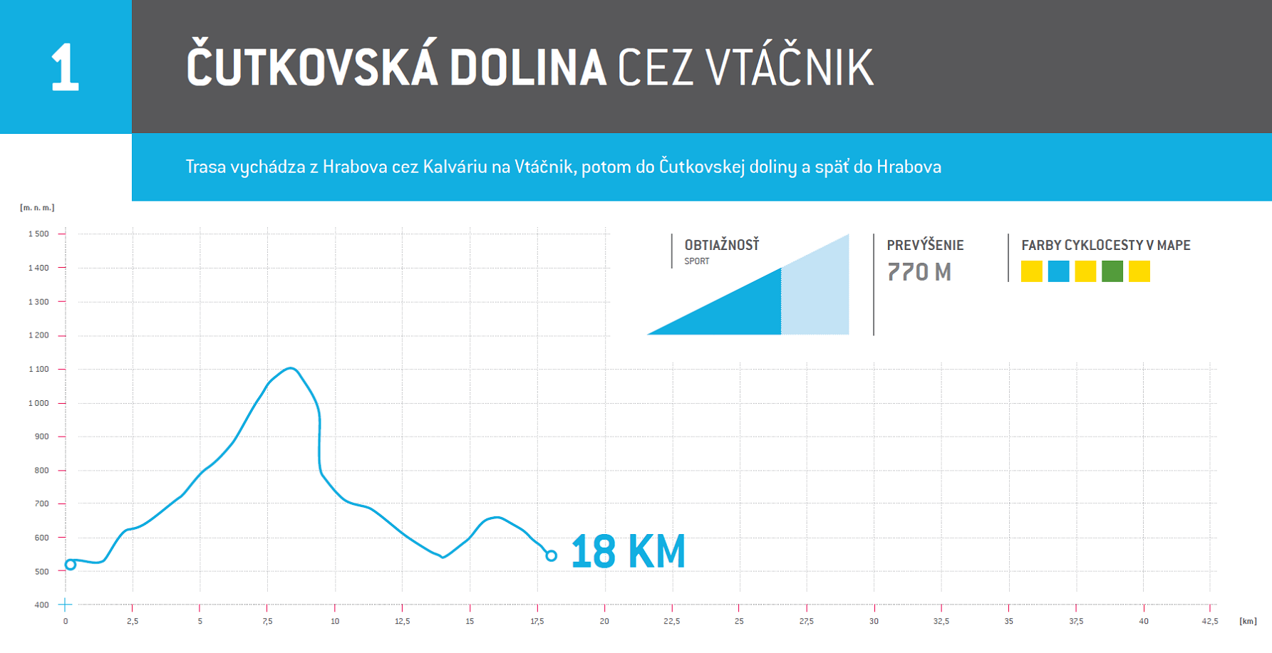
1. To Čutkovská Dolina through Vtáčnik
The route takes bikers from Hrabovo through Kalvária, Vtáčnik and Čutkovská dolina back to Hrabovo
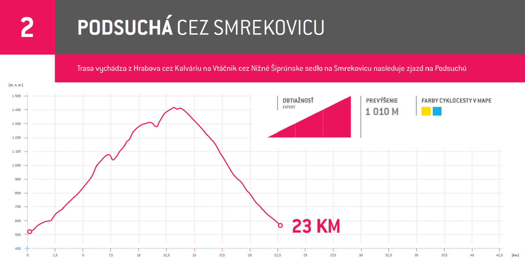
2. To Podsuchá through Smrekovica
The route starts in Hrabovo towards Vtáčnik and then continues through the Nižné Šiprúnske saddle and Smrekovica. It ends with a descent to Podsuchá.
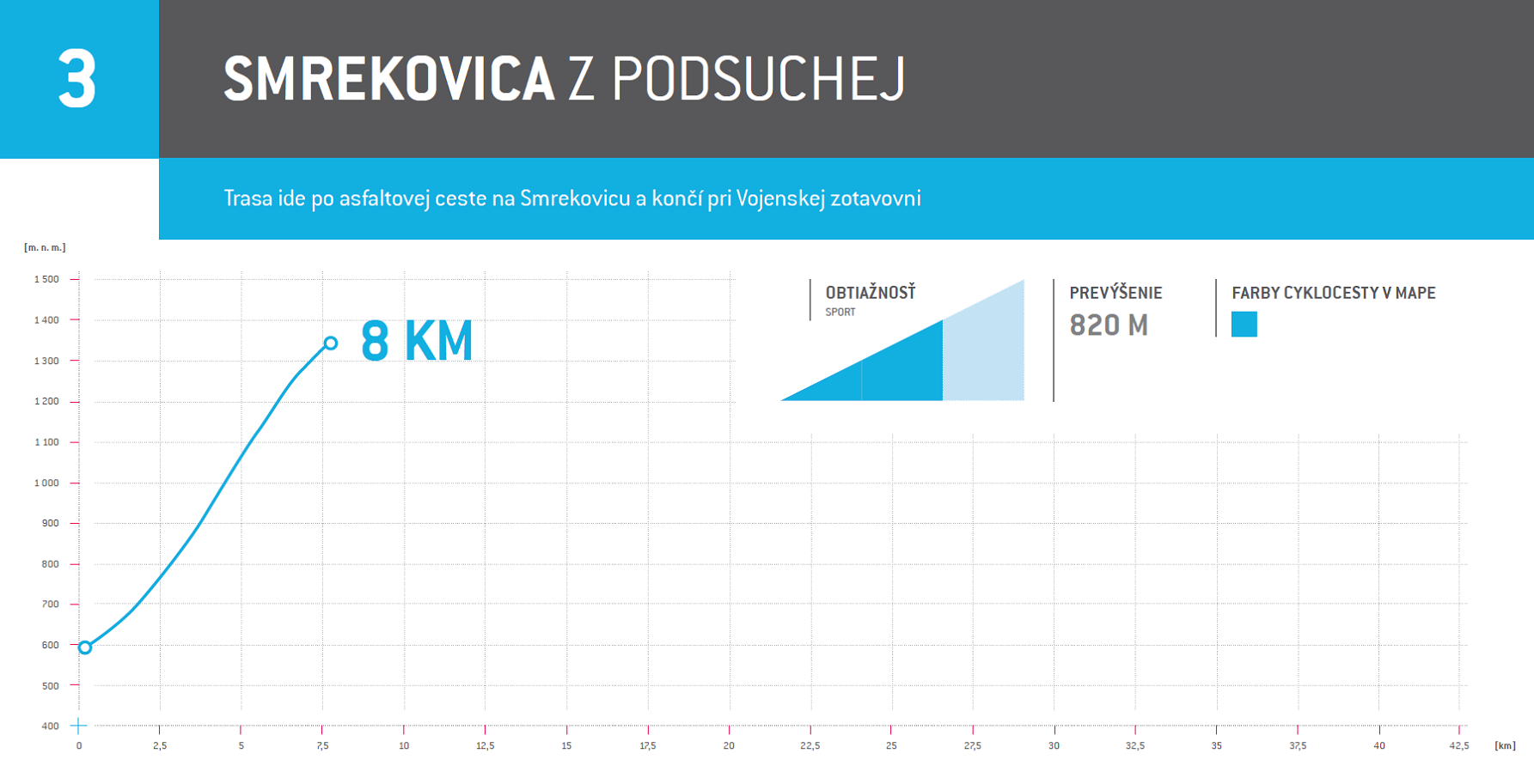
3. From Podsuchá to Smrekovica
The route follows an asphalt road to Smrekovica and ends at the Vojenská Zotavovňa military convalescent home.
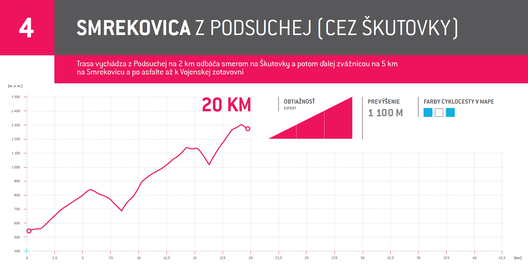
4. From Podsuchá to Smrekovica (past Škutovky)
The route runs from Podsuchá to Škutovky (2 km). From here it follows a path to Smrekovica (5 km) and an asphalt road to the Vojenská Zotavovňa military convalescent home.
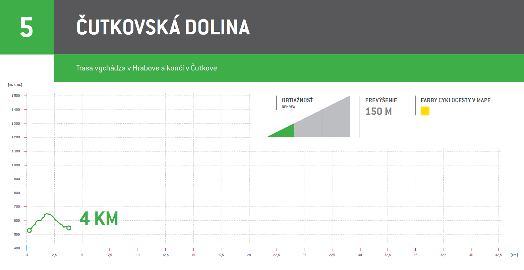
5. Čutkovská dolina
The route begins in Hrabovo and ends in Čutkovo.
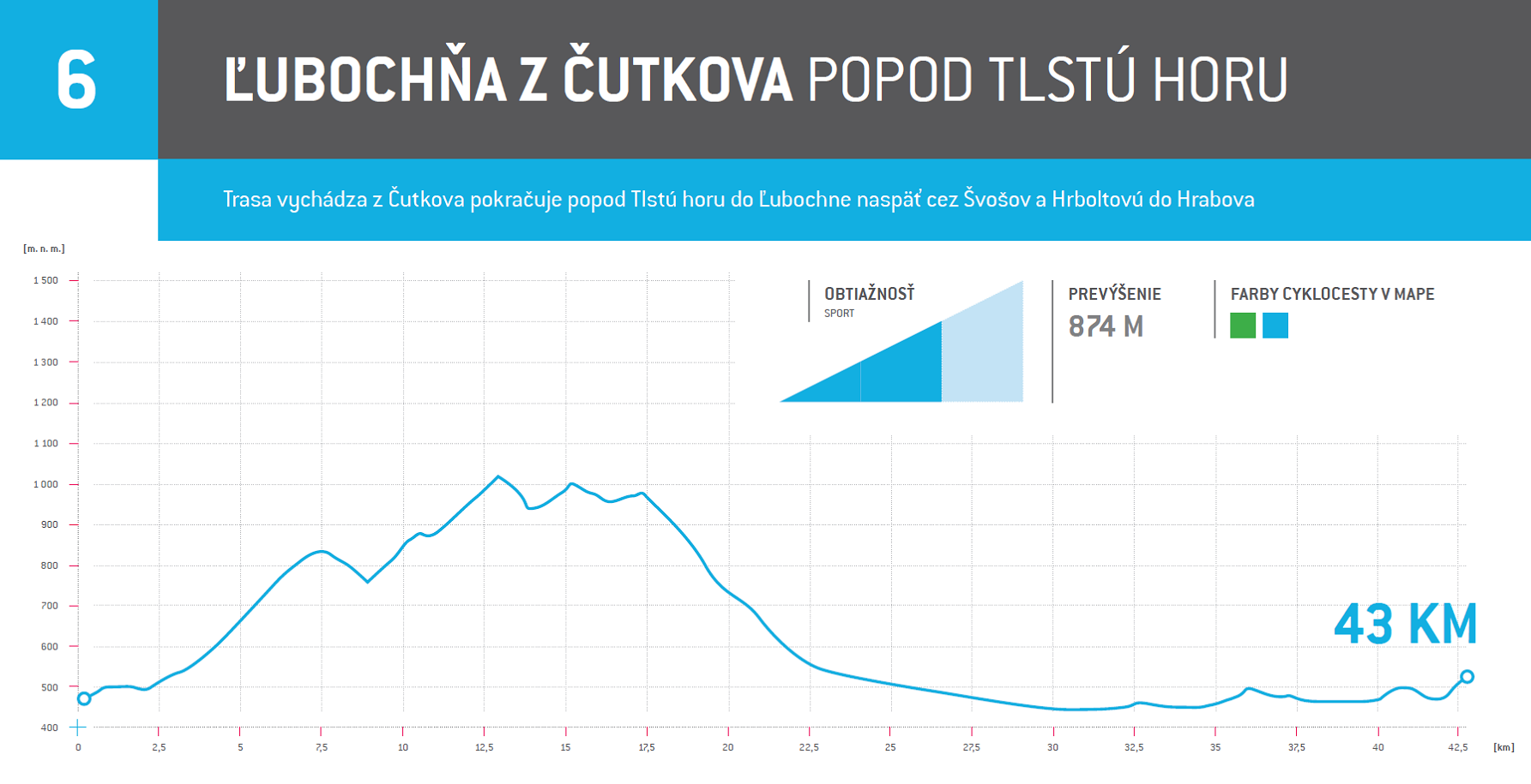
6. From Čutkovo to Ľubochňa past Tlstá hora
Beginning in Čutkovo, the route takes you past Tlstá hora to Ľubochňa and back to Hrabovo via Švošov and Hrboltová.
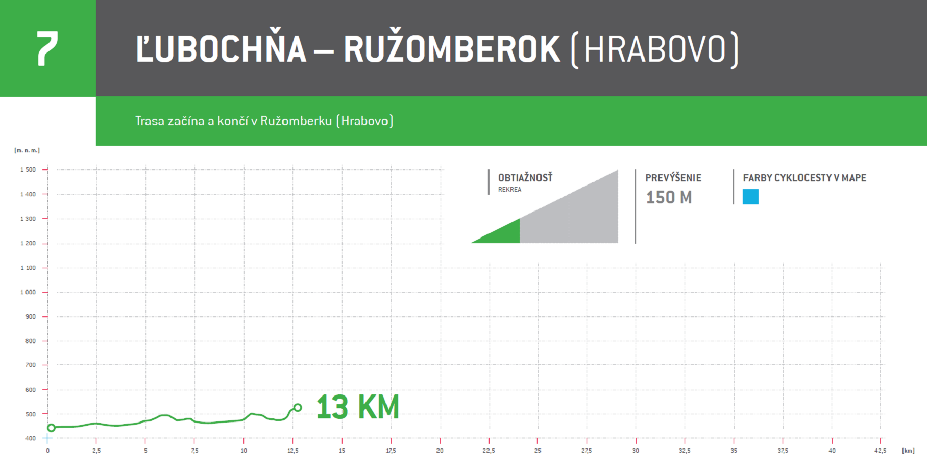
7. From Ľubochňa to Ružomberok (Hrabovo)
The route begins and ends in Ružomberok (Hrabovo).
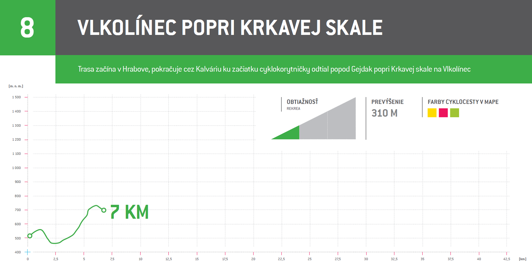
8. To Vlkolínec past Krkavá skala
The route runs from Hrabovo and continues through Kalvária to the beginning of Cyklokorytnička. From here it sweeps past Gejdák and Krkavá skala and into Vlkolínec.
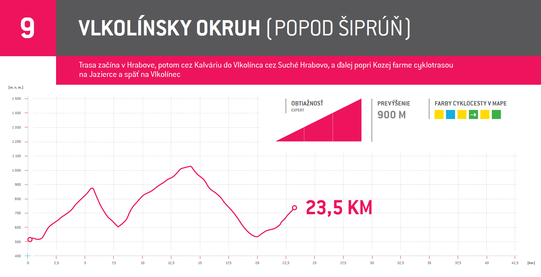
9. Vlkolínec loop (past Šiprúň)
The route starts in Hrabovo and continues through Kalvária and Suché Hrabovo to Vlkolínec. From here the route passes on past Kozia farma to Jazierce and back to Vlkolínec.
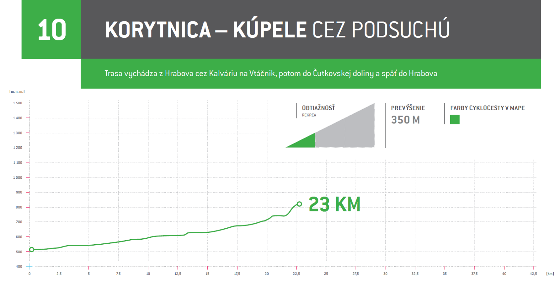
10. To the Korytnica Spa through Podsuchá
The route runs from Hrabovo and continues through Kalvária to Vtáčnik. It then passes on to Čutkovská dolina and back to Hrabovo.
Find inspiration in our list of TOP hiking trails
- Hiking time:
- Total elevation gain:
- Places of interests
Odporúčame Vám nasledovné turistické trasy:
1. Hrabovo – Kalvária – Vlčia skala – Sidorovo (1099 m) – Vlkolínec – Suché Hrabovo – Hrabovo
- Hiking time: 3,5 hod., 12 km
- Total elevation gain: 412 m
- Places of interests: Vlkolínec – drevená obec zapísaná v zozname UNESCO
2. Hrabovo – Kalvária – okruh okolo Sidorova – Kalvária – Hrabovo
- Hiking time: 3 hod., 11 km
- Total elevation gain: 324 m
3. Hrabovo – Šimunovo – Malinô Brdo (1209 m.n.m.) – Vtáčnik – Suché Hrabovo – Kalvária – Hrabovo
- Hiking time: 3,5 hod., 12 km
- Total elevation gain: 698 m
4. Hrabovo – Kalvária – Suché Hrabovo – Vtáčnik – Šiprúnske sedlo – Janošíkova kolkáreň – Smrekovica ( 1478 m.n.m.) – Podsuchá
- Hiking time: 6 hod., 23 km
- Total elevation gain: 938 m
- Places of interests: Smrekovica – recreation center, Janošíkova kolkáreň – national nature conservation area
5. Hrabovo – Kalvária – Malinô Brdo – Vtáčnik – Šiprúnske sedlo – Maďarovo (1331 mn.m.) – sedlo pod Tlstou horou – Čutková dolina
- Hiking time: 5 hod., 20 km
- Total elevation gain: 791 m
- Zelená (Green)
- Length: 4 300 m
- Average slope: 9,3 %
- Total elevation gain: 397 m
The easiest trail in the bike park, perfect for the first time down hill riders and families with kids. It is located below the upper station of the gondola cable car and is largely made up of forest paths and meadows. Rent a bike and equipment and enjoy your first time down hill mountain biking!
- Modrý zamat (Blue Velvet)
This freeride trail is one of the most popular trails in Ružomberok. It is a single track trail with the predominant surface being clay (90%). It features plenty of banked turns (app. 60), jumps, doubles, berms and waves. The trails is designed for beginner to advanced riders, allowing them to ride at their own pace. Highly recommended!
- Low Ryder
- Length: 500 m
- Average slope: 17,2 %
- Total elevation gain: 69 m
Low Ryder is a single track DH trail with no artificial obstacles. The ride starts on No. 2 trail and it connects to No. 4 trail after about 1,3 km. You can then ride into the trails No. 1, 2 and 4.
- Monster Dog
- Length: 1 600 m
- Average slope: 14,5 %
- Total elevation gain: 232 m
The trail is suited to advanced and experienced riders, with lots of tree roots, rocks and artificial obstacles, such as drops, doubles, a rock garden and wooden bridges. You can access the trail from Modrý Zamat (trail No. 2) after around 1,2 km. To get to the bottom, you can either follow trail No. 1 or trail No. 2.
- Intro
- Length: 500 m
- Average slope: 15,4 %
- Total elevation gain: 77 m
The Intro trail is the beginning section of a downhill route. It features a lot of tree roots, rocks, natural jumps, man-made doubles and a gap. The trail is a multi-user route designed for experienced riders. It connects to trail No. 4, which you can choose to ride to get to the bottom. You can also take trail No. 1 and trail No. 2.
- ENZED
- Length: 1 050 m
- Average slope: 20 %
- Total elevation gain: 200 m
The ENZED trail is best suited for the most demanding of riders. It has been designed in cooperation with world-class riders riding for the Banshee Bikes Factory Team, an international pro downhill race team led by Matej Charvát. The terrain is steep and technically challenging, featuring tight turns, open turns, roots and rocks. The first half of the track is the most challenging part, with two large double drops firing you into a steep rooty down-slope. The second half of the trail will challenge you with a techy traverse.
ENZED trail is the most difficult trail in the park. Its level of difficulty increases when it is wet and multiplies when it rains. Its difficult nature makes it popular among downhill mountain bike racers competing both nationally and internationally. You can access the trail from DH PRO (trail No. 7). After about 100 m, turn left. To reach the bottom, you can either take trail No. 4, 1 or 2.
- DH PRO
- Length: 1 000 m
- Average slope: 19,9 %
- Total elevation gain: 199 m
The track starts at the upper station of the gondola cable car and leads to Monster Dog (No. 4 trail). It is designed for the most demanding of riders. It includes plenty of technically challenging sections with open traverses, steep terrain, roots and rocks. DH PRO trail connects to trails No. 4, 1 and 2.
- Bidasken
- Length: 800 m
- Average slope: 11,5 %
- Total elevation gain: 92 m
The track is designed for the most advanced mountain bikers. Its construction was inspired by the North Shore Trail and so it is mainly made up of forest paths and wooden bridges of different shapes. You can access the trail from Modrý zamat (trail No.2) after around 1,7 km. The trail connects to trail No. 4 and also to trails No. 1, 2 and 4.
- Blizzard
- Length: 4 100 m
- Average slope: 9,7 %
- Total elevation gain : 392 m
The Blizzard is a trail designed to accommodate riders of all abilities, from beginners and hard tail riders right through to experienced enduro and downhill riders. The trail is a single-track route of variable surface types. Its natural and built parts will take you through meadow and forest terrain, packed full of small to moderate obstacles, such as terrain waves, small jumps, step-ups, wooden bridges, close as well as banked turns and several easy root and rocky passages.
Its low average slope and braking bumps remove the need for breaking sharply, making the ride flow smoothly. The overall length of the trail and its features will test your endurance and biking skills. Highly recommended to every XC trail, all-mountain, enduro and freeride/downhill rider.
- MALINA
- Length: 2 200 m
- Average slope: 10 %
- Total elevation gain: 280 m
- Difficulty level: blue
This newly built trail begins at the upper station of the chairlift and winds its way down the piste towards the saddle of the Malinô Brdo mountain. This section of the route offers wonderful panoramic views stretching over the Chočské Vrchy mountains, the Western Tatras and the Low Tatras. After around 1000 m, the trail enters the forest with some turns along the way and after some time it joins the Vlkolínska piste again. The trail traverses the slope and heads back towards the lower station of the chairlift.
- SUCHÁ
- Length: 3 000 m
- Average slope: 8,5 %
- Total elevation gain: 380 m
- Difficulty level: green
This trail also begins at the upper station of the chairlift located at the top of the Malinné mountain. It enters the forest with a steeper descent and then it connects to a section made of gravel and broken asphalt paths. The trail finishes in the Vlkolínske meadows, next to the Mini Zoo, just at the foot of the Sidorovo mountain.
Electric buggies and a bouncy castle at Aprés-ski are new. On Maline Brda, during the summer holidays, you will find an off-road track with electric buggies for children, who will become little drivers and riders who can go crazy to their heart’s content. Or even the little ones can go crazy on the bouncy castle with the slide while the parents enjoy a refreshing drink or coffee on the terrace.here.
When visiting the resort, don’t forget the adrenaline ride on an all-terrain scooter or mountain cart along a 4.5-kilometer route directly from the cable car exit to Hrabov. The trip takes about 20 minutes, during which you will enjoy fun and driving through beautiful nature on an asphalt road. If you have enough time, an interesting option is to rent e-bikes, with which you can experience effortless bike tours around the area.
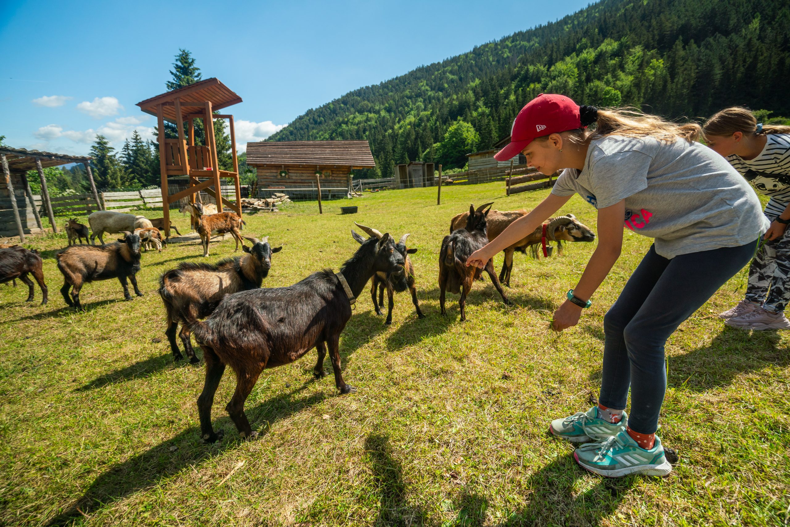
Among the sought-after easy tourist routes is the Mevedia cesta educational forest trail, on which you will learn interesting facts about the brown bear from information boards. The route is 4.5 km long and even the smallest can handle it. Another sought-after location is Vlkolínec, which is included in the list of UNESCO monuments. It is only 40 minutes away from the top station of the cable car, and along the way you will also visit the Sidorovo Minifarm. The route is 2.4 km long and follows a hiking trail. You can find other types of hiking here: https://skipark.sk/aktivity/bikepark/turistika/
In summer, the center is a paradise for bikers. You will find 11 tracks where even the most experienced riders will test their skills! You will find more than 30 km of tracks of varying difficulty. You can comfortably ride the 8-seater cable car with your bike and ride as much as you want.

Please describe your experience