


Mt Baranec (2184m) is a peak overlooking Liptovský Mikuláš. Along with Mt Kriváň, it is a dominant part of the town’s panorama and undoubtedly one of the most visited peaks of the Western Tatras and the region of Liptov. The reason is that the trail leading to Mt Baranec can also be a circle, complemented by a stop at the cottage of Žiarska Chata.
The tour starts at the paid car park at the mouth of Žiarska Valley, from where you take a steeper ascent along the yellow trail up to a forest and a fork of Holý Vrch (a peak) offering stunning views of the whole region of Liptov. After reaching the peak of majestic Mt Baranec (2184m) you will take an easy descent through Smrek up to the saddleback of Žiarske Sedlo (1917m) and then a steeper descent along the green and blue trail through the Žiarska Valley towards he cottage of Žiarska Chata. There you can get some food and drinks all the year as well as use accommodation services. From the cottage you have various options where to go hiking. You can continue downwards along an asphalt road or use the blue former hiking trail through the forest with an educational path or you can rent a scooter to get down to the car park – your finish poin
You can park on the paid spacious car park loacated at the mouth of the valley. You can also use the local bus service from Liptovský Mikuláš. The end bus stop is located approximately 400m from the starting point.
There are several food and accommodation facilities in the village of Žiar and the Žiarska Valley. At the beginning of the trail there is the cottage of Chata Kožiar providing accommodation and food as well as the cottage of Žiarska Chata which is situated at the hiking trail.
If you want to form a proper knowledge basis about this part of Liptov, the smallest city of area called Liptovsky Hradok is the most certainly best one to start with. City with traditions of forestry, woodworking industry, metallurgy, trade, as well as original art goes hand in hand with beautiful countryside. Wander through the places walked by history and the people who have created this city, places still interesting and attractive to see today. The educational path connects the two oldest settlements which were previously generated in the Liptovsky Hradok – Belsko settlement and settlement of Mravnik.
Across the Liptovsky karst if you want to experience what is uncovered only for „explorers“ – you must descend into the depths and become friends with the elements formed during the millenniums. The journey allows you to enter mysterious world of unique spaces underground, which are bear witness of the nature forces and sensitive human intervention. In its ending, you will sense over other natural dimension in the green embrace of the arboretum. (There are more than 4,000 known caves and chasms in Slovakia, 16 are available to the public, of which there are 4 in Liptov.)
Find and booked your accommodation – HERE.
Experience other than visual, ok, no problem. You can direct your steps to places where the ground offers a refreshing mineral water for those who are attracted to take a pleasant sip straight from the source.
Liptovský Hrádok, Hradná ulica, in front of the forestry school building – Socha Raneného diviaka (Statue of the Wounded Wild Boar) (1), Dovalovo – Catholic church with the houses of Liptov masons at the upper end (2), from there you will pass by Kaplnka nad Dovalovom (the Chapel above Dovalovo) (3) along the meadow-forest road to Červený kút (4). Then after a short section along the I./18 road you will reach Štróblova vila (Štróbl’s villa) (5) and take a peek at the Mašiansky balvan boulder. The way back leads through Liptovská Porúbka (6) to Liptovský Hrádok (7).
(1) Liptovský Hrádok – Statue of the Wounded Wild Boar
The Statue of the Wounded Wild Boar, from 1902, came from the workshop of the important sculptor Alojz Štróbl, born in today’s Kráľova Lehota, in the past a settlement that was part of Liptovský Hrádok. The original statue was first located at Štróbl’s villa in Kráľova Lehota, from where it was later moved to the English park in front of the Jozef Dekret-Matejovie Forestry School, where it stands to this day. In 2011, the Town of Liptovský Hrádok classified it as an important monument.
(2) Dovalovo – Catholic church
Go along Hradná ulica, past the castle and the manor house with its lake, and you will reach the Dovalovo district, where the Early Gothic Roman Catholic Church of St. Martin is located, dating from the second half of the 13th century, and a defensive wall from the 17th century.
DOVALOVO – HOUSES OF LIPTOV MASONS At the upper end on the right side of the road along the marked bike trail, you can admire the masonry art of the celebrated Liptov masons, who became famous for the construction of Pest (today’s Budapest). The most famous of them was undoubtedly Ján Nepomuk Bobuľa, and you can stop by the house in which he was born on your way.
(3) Chapel above Dovalovo
Climb a steeper hill to get to the most beautiful place in Dovalovo, the chapel, offering a beautiful and extensive view of the surroundings with the Tatra peaks in the background. According to tradition, the chapel was built after a tragic event in 1692 (a shepherd and his oxen were killed here during a storm).
(4) Červený kút
Go along the forest path using the green bike trail to get to the Červený kút locality, where you can relax and recharge your batteries enabling you to uncover more attractions on the route.
(5) Štróbl’s villa – Kráľová Lehota
Alojz Štróbl was the most celebrated Hungarian sculptor in the 19th century. Although he worked in Hungary, he could never forget his home, Liptov. In 1891, he bought the house in which he was born in Kráľova Lehota, and converted it into his family residence. He transformed the original cottage into a copy of Vajdahunyad Castle, the seat of King Matthias Corvinus in Transylvania. By May 1906, the rough construction of the building and the tower was already finished. The servant buildings and outbuildings were completed in 1907. The artist had his studio on the ground floor of the tower, while the painting studio of his sister Žofia was above it on the first floor. If you cross the bridge and turn right after it, you will reach the left bank of the Váh River. About 2 km further on there is the Mašiansky balvan boulder. This is a unique stone formation – a boulder-like remnant of a river terrace created as a river island. The boulder is 20 metres high and is included among our natural monuments.
(6) Liptovská Porúbka
Follow the asphalt road under the mountain to reach Liptovská Porúbka after about 6 km. The bike trail is marked in red. The surroundings of the municipality offer a range of beautiful natural attractions for locals and visitors. Most of the cadastre is part of the Low Tatras National Park and its protection zone. The area includes the Ohnište National Nature Reserve. The ascent of Slemä (1513.7 m above sea level) is also interesting. During World War II, a transport plane crashed into the peak and the entire crew died. A memorial mound and a plaque with the names of the victims stand next to the remains of the plane. The hiking trail also passes by two partisan bunkers dating from World War II.
(7) Liptovský Hrádok – Námestie Františka Wisnera (František Wisner Square)
You are once again back home, in the town from which you set out on your cycling journey. Just looking at the eye of the fountain in the centre of the square will refresh you, not to mention the use of the summer terraces.
Starting point: 49.040797; 19.728577
There are paid and free parking spaces in Liptovský Hrádok.
Take the train or bus to Liptovský Hrádok and then the bus from Liptovský Hrádok to the surrounding municipalities. It is best to complete the route by bike or on foot.
There are several accommodation facilities in Liptovský Hrádok. There are also food options in both summer and winter, in the hotel’s restaurants or snack buffets.
The route starts in the Jasná ski resort in the parking lot in front of the Grand Hotel and the first ascent goes through the Zadná voda valley to Polana Saddle (1,837 m above sea level), which lies on the main low-Tatra ridge. In the saddle, turn left/east / and follow the red sign (EB, 0801). By a gentle climb, we reach Dereš (2,003 m above sea level) and later we reach Chopok (2,024 m above sea level) through a shallow bend. The path does not go all the way to Dereše peak, but due to the nice view, it pays to take a small walk.
At Kamenná cottage on Chopok, you can have a snack and then climb to the eastern peak of Chopek, which rises above the cottage itself. The route continues along the busiest section of the main ridge of the Low Tatras and then begins the descent to Demänovské saddle (1,756 m above sea level). If we want to get to the crossroads of tourist roads Krúpovské saddle (1,922 m above sea level), it is necessary to take a short ascent. At the crossroads, we can go towards the top of Ďumbier (2,043 m above sea level). However, we take the north-western path, marked with a green sign (5426), leading to the Široká valley (1,390 m above sea level). The trail is winding and steep in places. In Široká valley we will connect to route no. 37 and go down to the cottage on the meadows in Lúčky (925 m above sea level).
Paid and free parking are available at the ski resort.
By train or bus to Liptovský Mikuláš and then by bus from Liptovský Mikuláš to the resort Jasná Nízke Tatry (Demänovská dolina) to Demänovská Cave of Freedom.
There are several accommodation facilities in the Jasná Nízke Tatry resort that offer accommodation. Dining options are provided, whether in summer or winter, in the hotel restaurants or snack bars.
The route starts at the large car park for the Lúčky cable car. We follow the green hiking trail through the cottage area to the signpost, where we join the red trail. On the steep dirt road that also serves as a ski slope, a view opens of the Jasná ski resort and other peaks of the Low Tatras – Poľana, Bór(y) and Siná. Leave the dirt road and enter the forest, where you can catch your breath in a shelter and then continue over a wooden bridge along an ascending path following the creek to the Javorie sedlo. From the saddle you can follow the yellow trail in the direction of Ďumbier or the red trail towards Jánska dolina (Pred Bystrou). However, we will follow the yellow trail to the north – in the direction of Kosienky. After about 30 minutes, we will pass through Kosodrevina and arrive at the Kosienky crossroads, where we will turn north (to the left). We will arrive at the top of Krakova hoľa (1,752 m) within 30 minutes.
Starting point: 48.979859; 19.594138
There is a paid car park at the ski resort.
By train or bus to Liptovský Mikuláš and then again by bus from Liptovský Mikuláš to the Jasná Nízke Tatry resort. From here there are various transport options, whether you choose to hike or take the cable cars directly to Chopok.
At the Jasná resort there are several accommodation facilities. Food is available in both summer and winter in the hotel restaurants and snack buffets.
To the top of the highest point of the Western Tatras Bystra we can go from three valleys, from Kamenisté valley from Podbanského, from Bystra valley from the settlement Hrdovo to Gáborova valley, which separates from Račková valley. The most frequently used route is probably the ascent from Podbanského Kamenista valley to the Pysne saddle where the blue marked path will lead us. From the saddle we continue along the border ridge (red) to Blyšť. The blue sign continues to the top of Bystra. From the top there is a circular view of the Polish part of the Tatras, Roháče, Western and High Tatras. The descent to the Bystra valley is along a yellow marked path, above the settlement of Hrdovo we connect to the red trail, which will take us back to Podbanske.
There is paid and free parking in Prybiline.
By train or bus to Liptovský Mikuláš or Liptovský Hádek and from there by bus to the village of Pribylina.- itinerary
In Pribylina there are several accommodation facilities that offer accommodation. Dining options are provided, whether in summer or winter, in the hotel restaurants or snack bars.
The route starts at the mouth of the Žiarská dolina (880 m) at the blue marker (2707), which is followed for a short section along with the red and yellow markers. After an easy ascent to the Žiarska hut (1,300 m), we continue past the Mountain Service house to the signpost, where we cross the green marked path (5610). He will bring us to the Jalovecký saddle. Next to the Pietna place for the victims of mountain accidents in the Western Tatras, we traverse the southern slope to the stream. We climb up on its right side, cross the stream under the Šarafi waterfall to the left and reach another gully after a long climb. We ascend the serpentine path between the rhombus to the wide Jalovecký saddle (1,858 m).
From the saddle, we continue to the right along the grassy (later rocky) ridge to Príslop (2,142 m). We descend over a steep rocky ridge to a smaller saddle. We will bypass part of the “toothed” ridge on the left, then climb the southern rock ridge to Baníkov (2,178 m), the highest peak on the main ridge of the Western Tatras. We continue in the eastern direction following the red signs (0862). Extremely exposed parts secured by chains await us (they are very dangerous when wet and icy). Through the rock cut with safety, we descend around the so-called rock needle into a looser terrain. Behind the wide meadow saddle, we climb to the second highest peak of the hike – Hrubú kop (2,166 m).
After a short rest, we descend to the saddle. This is followed by a passage through the exposed Three Rocks (2,136 m), which is ensured by artificial aids. The technically demanding passage should only be completed in good weather. From the last hill, we descend on a scree trail to Smutné sedlo (1,963 m). From the saddle, we continue to the right along the blue-marked path (2707), which is carved into a very steep slope, to the branch of the Prostredné grúň. We continue along the undulating ridge to a small shallow saddle, from which we can reach the valley via a short serpentine on the left. We take the paved path leading through the small terrace to the crossroads to Žiarske sedlo and then follow our route for about 45 min. we will find ourselves at the Žiarská chata. With a comfortable descent down the Žiarská dolina, we will end the trip at the SAD stop just below the mouth of the Žiarská dolina.
Time schedule: Mouth of Žiarská dolina – Žiarska chata 1 ¼ h – Jalovecké sedlo 1 ½ h – Baníkov 1 h – Hrubá kopa 1 h – Smutné sedlo 1 h – Žiarska chata 1 h – mouth of Žiarska dolina 1 h Total: 7 ¾ h From 1 From November to June 15, the trail is closed.
Start location: 49.144532; 19.699909
There is a paid parking lot in Žiarská dolina.
By train or bus to Liptovský Mikuláš and then by bus from Liptovský Mikuláš to the village of Žiar, or to the beginning of the Žiar valley.
In the village of Žiar there are several accommodation facilities that offer accommodation. Dining options are provided, whether in summer or winter, in hotel restaurants or snack buffets.
Siná and Bôry are without doubt the natural jewels of the Demänovská dolina valley. Our hike will be quite long and leads from the Demänovská jaskyňa slobody cave along the yellow trail to Siná (1560) and Bôry (1888) and the peak of Poľana (1890), located on the main ridge of the Low Tatras. Continue through Tri vody to Jasná, from where you can continue along the yellow trail back to Demänovská jaskyňa slobody, or you can shorten this section by scheduled bus. Please note that there is a seasonal closure in the Sina-Bôry area from 1 October to 30 June. (Source: Hiking.sk)
Starting point: 48.998424; 19.584884
By train or bus to Liptovský Mikuláš and then again by bus from Liptovský Mikuláš to the Jasná Nízke Tatry resort.
At the Jasná resort there are several accommodation facilities. Food is available in both summer and winter in the hotel restaurants and snack buffets.
This very nice route starts in Smrečany. The already mentioned Gothic Church of the Sacrifice of the Lord (blessed in honour of the Purification of the Virgin Mary), the foundations of which date back to 1349, is the oldest preserved building in Smrečany. Do not miss the village museum; its permanent exhibition called „The History and the Important Personalities of the Village“ chronicles the history of the Smrečany village and displays a selection of traditional folk crafts, farm tools, folk costumes, period documents, photographs, etc. The Smrečany village merges with the Žiar village, at the end of which you will find The Chata Kožiar mountain hotel with the on-site snack bar and information boards. From the hotel, turn onto an asphalt road that will lead you to the Žiarska Chata chalet. The route can be explored on foot, by bike and there is also a possibility of renting a downhill scooter, with the road having a dedicated lane for scooters. You will see an occasional car or two. A quieter alternative to the asphalt road is an old trail through rocky forest terrain marked blue. It runs parallel to the busy supply road, but it leads through a spruce forest, providing shade from the sun. A recently renovated Žiarska Chata chalet provides accommodation with the “Tri Kopy” restaurant and an outer terrace. There are many natural beauties worth seeing just a stone´s throw from the Žiarska Chata chalet. One of them are the cascades of the Šarafiový Vodopád waterfall in the Krásno rock gully. To reach it, follow the path to Jalovecké Sedlo saddle marked with green markings that will lead you past the Symbolický Cintorín cemetary to the frothy white cascades of the Šarafiový Vodopád waterfall.
Starting point: 49.120129; 19.650750
There is a paid parking lot at the beginning of the Žiarska Dolina valley.
You can get a bus or train to Liptovský Mikuláš and then a bus to the Smrečany village or you may prefer to take a bus which stops next to the Salaš Kožiar sheep farm.
There are several accommodation options available in the villages of Smrečany and Žiar and also a number of restaurants, chalets and snack bars where you can dine in both summer and winter.
Hike to the second highest peak of the Western Tatras via Račková and Jamnícká valleys.
There is a paid parking lot in the Liptov Museum in Pribylina.
By train or bus to Liptovský Mikuláš or Liptovský Hrádok and from there by bus to Pribylina.
In Pribylina there are several accommodation facilities that offer accommodation. Dining options are provided, whether in summer or winter, in the hotel restaurants or snack bars.
Poludnica is a very attractive peak for tourists. It rises to a height of 1,548 m above sea level and is only seven kilometres from the centre of Liptovský Mikuláš as the crow flies. These facts ensure Poludnica offers a beautiful view of the whole Liptov region. The shortest ascent is along the blue trail from the village of Iľanovo. However, even though it is only 5.5 kilometres in length, you should plan on taking at least two and a half hours to climb the almost 900 metres of elevation. You can return by the same route, or follow the yellow trail to Závažná Poruba, or continue along the blue trail to the saddle below Kúpeľ and then take the green trail to connect to the yellow one to Závažná Poruba. Our tour proposal follows the latter option. (Source: Hiking.sk)
Miesto štartu: 49.048943; 19.613448
Free parking is available in the village.
By train or bus to Liptovský Mikuláš and then again by bus from Liptovský Mikuláš and then by city bus from Liptovský Mikuláš to the village of Iľanovo.
In the villages of Iľanovo and Závažná Poruba there are several accommodation facilities. Food is available in both summer and winter in the hotel restaurants and snack buffets.
The route leads from Liptovské Revúce (Veľká Fatra) to the saddle below Čierny kameň, on past Minčol (1398) and Južné Rakytovské sedlo to Rakytov (1567). This dominant peak has a distinctive pyramidal silhouette and offers a beautiful 360° view of Veľká Fatra, the Low Tatras and, when there is good visibility, the entire ridge of the Western Tatras and parts of the High Tatras. From Rakytov we continue past severné Rakytovské sedlo to the Útulni Limba shelter, where you can purchase refreshments. The route continues through the Teplá dolina valley to the gamekeeper’s lodge and along the asphalt road back to Liptovské Revúce. (Source: Hiking.sk)
Starting point: 48.919088; 19.177596
Free parking is available in the village.
By train or bus to Ružomberok and then by bus directly to the village of Liptovské Revúce or with a transfer in the village of Liptovská Osada.
There are several accommodation facilities in the villages of Liptovské Revúce and Liptovská Osada. Food is available in both summer and winter, in restaurants, guest houses and snack buffets.
This route in the heart of the Low Tatras begins at Demänovská jaskyňa slobody and leads mostly along the blue trail to the top of Mt. Chopok (2048). This section can be shortened by using cable cars, saving about four hours of time and 1200 metres of climbing. Refreshments are available at Kamenná chata (2000) just below the peak of Chopok. We then continue along the red trail through Krúpovo sedlo to Ďumbier (2043), the highest peak of the Low Tatras. This section provides some of the most beautiful views in all the cardinal directions – Liptov, Spiš, Horehronie, the Western and High Tatras and the Slovak Ore Mountains are in the palm of your hand. The route continues back to Krúpovo sedlo, from where we continue along the green trail to Široká dolina and then through Lúčky back to Demänovská jaskyňa slobody.
Starting point: 48.998446; 19.584867
There are paid and free parking spaces in the ski resort.
Take the train or bus to Liptovský Mikuláš and then the bus from Liptovský Mikuláš to the Jasná Nízke Tatry resort (Demänovská dolina) to Demänovská jaskyňa slobody.
The Jasná Nízke Tatry resort has several accommodation options. There are also food options in both summer and winter, in the hotel’s restaurants or snack buffets.
A cable car will take you to Chopok directly from Biela púta (A6 funitel) to Priehyba. There you will change to the A1 funitel, which will take you to the top station on Mt. Chopok (2004 m above sea level).
Route: follow the red hiking trail past Kamenná chata, then through Demänovské sedlo and Krúpova hoľa to Ďumbier 2043 m above sea level. Return to Mt. Chopok by the same route.
Starting point: 48.943945; 19.590059
There are paid and free parking spaces at the ski resort – more details at jasna.sk
Take the train or bus to Liptovský Mikuláš and then the bus from Liptovský Mikuláš to the Jasná Nízke Tatry resort (Demänovská dolina). From there, there are various transport options, whether you choose the option of hiking or taking cable cars directly to Mt. Chopok.
At Jasná Nízke Tatry resort there are several accommodation facilities. There are also food options in both summer and winter, in the hotel’s restaurants or snack buffets.
A bidirectional linear trail with 12 information panels focusing on nature protection, biology and history acquaints visitors with flora and fauna, documents the development of relief as well as anthropic influences in the most visited central part of the Low Tatras. The trail is suitable for intermediate tourists. It is a part of marked hiking trails and may be completed in less than 5 hours. A respective part of the nature trail is also accessible by a mountain bike.
Start your journey at the parking lot in front of the Grand Hotel located in the recreation area Jasná, east of the mountain tarn Vrbické Pleso (1102 m asl). Walk around the natural mountain lake along the northwest path until you come to the cottage of Mikulášská Chata. Besides the nature trail boards beneath Mt Otupné, follow the yellow tourist signs. Along the stream of Zadná Voda, you will climb up the valley of Zadná Voda to reach the fork of Tri Vody (Three Waters) (1370 m asl.), where you turn left onto the red marked trail. You will head out on the traverse along the difficult slopes of the main ridge of the Low Tatras in the Demänovská Valley. The trail slightly ascends through the northern wooded hill of Mt Dereše up to Mt Brhliská (1430 m asl.) at the upper station of a cabin cable car. The trail is slightly ascending after crossing the ski slope, and from the fork of Pod Orlou Skalou (1460 m asl.) it starts ascending more steeply. The serpentines run through scrubland onto the slopes of Mt Chopok. There is an inclined traverse that starts behind the last bend and ends at the lower station of the chair lift from Jasná to Luková. From there, the trail mostly just descends. The first section of the descent down the slope will lead you to the chairlift intermediate station (1500 m asl.) from Záhradky to Konský Grúň. From there, it further descends along the edge of the scrubland to the mountain peak of Pekná Vyhliadka (1360 m asl). Then the tour profile changes. The trail turns right and traverses through the slope to a fork in the valley of Široká Dolina (1390 m). Here you will join the green marked trail which will lead you down along the stream of Demänovka and through the valley of Široká Dolina to the fork of Pod Krčahovom (1040 masl.). Discovering the natural wonderss of the Demänovská Valley is finished at the cottage of Lúčky (925 m).
Regular bus service is available on the route Demänovská Valley and Liptovský Mikuláš, which is relatively well-timed to meet the tourists´ needs. Both the starting point and finishing point are situated directly at a bus stop. There is also a spacious car park. Parking is free of charge.
Situated at the beginning of the nature trail by the mountain tarn of Vrbické Pleso, there is the cottage of Mikuláška Chata, where you can refresh yourself. Another possibility is at the end of the trail, in the locality of Lúčky. Gastronomic facilities in the locality of Luková which are approximately half-way along the trail are not open in the summer.
The widest selection of accommodation and gastronomic facilities within the Liptov region is directly in the Demänovská Valley.
From the trail above the Kosodrevina restaurant, we turn right and follow the blue trail to the cottage of General M.R. Štefánik. From there, we descend along the green trail to the car park at Trangoška.
Starting point: 48.932718; 19.599176
The ski resort offers both paid and free parking.
By train or bus to Liptovský Mikuláš and then by bus from Liptovský Mikuláš to the Jasná Nízke Tatry resort (Demänovská dolina). From here there are various transport options, whether you want to hike to take the cable car directly to Kosodrevina.
There are several accommodation facilities at the Jasná Nízke Tatry resort, as well as on the south side of Chopok. Food is available in both summer and winter in the hotel restaurants and snack buffets.
The Ostredok Lookout is located just a few minutes’ walk from the parking lot in the Biela púť location in the Jasná – Nízke Tatry ski resort. The starting point and the direction sign are also visible from the parking lot.
You turn off the main road at the cross and continue along the easy hiking route following the yellow sign. The tower was built only recently and offers tourists views of Chopok and the panorama of the Low Tatras, as well as the ski resort. There is a picnic table and benches under the lookout tower.
The hiking trail continues to the Symbolic Cemetery for the Victims of the Low Tatras and on to the Demänovská Cave of Freedom. In the chapel at the symbolic cemetery, there are tablets with the names of people who perished in the Low Tatras. There is also a statue of “Mountain Pieta”, which symbolizes a mother’s grief over the loss of a child. Inside the cemetery there is a Slovak coat of arms and a bell, which were cast by artists from Liptovský Mikuláš, as well as a monumental six-meter wooden cross, which was carved by a carver from the village of Kriváň.
Free gravel parking along the road is right at the starting point at the signpost. The starting point and the direction sign are also visible from the parking lot.
The nearest bus stop is located in Demänovská dolina near the Hotel Grand Jasná. Regular bus connections go from Liptovský Mikuláš.
Meals and accommodation are available in nearby hotels, restaurants or buffets. Demänovská dolina or the Jasná Nízke Tatry resort provides a wide range of services of all categories all year round.
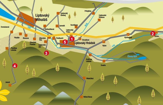
(Náhľad mapy: hiking.sk)
LIVE cam
This is one of the most attractive trails in the region of Liptov. Not only for its beauty but also for the history. Mt Kriváň (2494 m) is considered to be a national symbol of Slovakia and a national ascent of the peak has been organised for many years. The hike itself is quite demanding but it is definitely worth taking it.
You are beginning at Tri Studničky, a place reachable from the main road running from the village of Podbanské to the High Tatras. Here you can find a free parking place. The trail continues through a dwarf mountain pine area where you can admire the attractive views of the whole region. The trail is undemanding up to the couloir of Krivánsky Žľab and it is marked with a green colour. From this place on the difficulty of the trail rises also for the rocky terrain. Continue along the blue trail. The final view and mainly the feeling that you conquered Mt Kriváň (2494 m) is worth it. To complement the way back, more demanding hikers can first turn to the mountain tarn Jámske Pleso and then return to Tri Studničky along the red trail through the former cottage of Važecká Chata. So the tour will be extended by 4 kilometres which takes less than an hour. We recommend to travel by car and use the free parking at Tri Studničky. There is also a paid car park at the former cottage of Važecká Chata. You can also use a bus running to the bus station near the cottage of Chata Kpt. Rašu but it circulates very rarely.
We recommend to travel by car and use the free parking at Tri Studničky. There is also a paid car park at the former cottage of Važecká Chata. You can also use a bus running to the bus station near the cottage of Chata Kpt. Rašu but it circulates very rarely.
There are no mountain cottages and shelters along the trail. There are just some private cottages in the locality of Tri Studničky. A wide range of accommodation facilities and restaurants are located a bit further, in the locality of Podbanské.
Mt Ďumbier with its heights of 2043m is the highest peak of the Low Tatras. But an ascend to the peak is not one the most difficult. We recommend taking the trail from Lúčky through the valley of Široká Dolina and back along the mountain ridge across Mt Chopok and Luková up to the cottage of Mikulášska Chata. Here you can take a bus to transport you to Lúčky or directly to the town of Liptovský Mikuláš.
The trail is effortless, enriched with stunning views of the both directions of the Low Tatras. We can have a rest and get new energy in the cottage of Kamenná Chata or at Restaurant Rotunda which are situated approximately halfway your tour. What´s interesting is that either an ascent or a descent may be shortened by a cable car journey over the resort of Jasná. Bus service is available and operates very well. Timetable>>>
The starting point as well as the finish point of your tour is directly at the bus stop. Using a car is also a good choice as you can take advantage of free parking with enough capacity.
You can also take advantages of gastronomic facilities found along the trail, such as the cottage of Kamenná Chata or Restaurant Rotunda. Even the cottage of Štefánikova Chata offers refreshments and a place to spend a night, though it is a half-hour walk outside the trail.
(Preview map from hiking.sk)
We leave the car in the car park at the church in the centre of the village. From there, we take the asphalt road and walk for about 20 minutes to the thermal lake. The way is pleasant, with Veľký Choč mountain peeking out at us to the left from behind the houses. To my amazement, the road is quite busy. The thermal lake is evidently popular, and so there are quite a few cars and even a caravan parked on the narrow road.
We continue through a nice valley alongside a stream, under tall conifers. We start looking for a right turn upwards. We are tempted by a forest path, and in two minutes I am exploring a meadow with a trail, but this is not yet the one we want. We return to the asphalt and soon turn right onto the yellow hiking trail. We are greeted by a wheeled forest tractor and behind it an incredibly muddy trail. On the right I see a path through the forest, but I don’t want to climb over the logs and jump over the stream, so we continue along the trail, interested to see where the markings will take us.
The path continues winding in the same direction as the trail, so we return to it for now at least, yet sometimes it disappears, so we break through the bushes and return to the trail, then to the path again. Some horseflies find us. I kill them quickly, but not before they bite.
There is gradually less mud, and so we end up walking along a forest trail with deep rutted tracks. After about 40 minutes, we see a grassy saddle. It’s beautiful here and we immediately feel much better. On the right I see our hill, and so we head across the meadow to its foot and then lay out a small picnic in the shade on the forest path. The view of Sielnická hora mountain is beautiful, and now all that remains is the last hike to the castle. The path is steep. Below the summit we meet a Czech couple doing the same walk.
Soon I see the first castle wall and we are at the highest point of the hike. The castle grounds are beautiful, although there is not much of the walls left. From the notice board we learn that the first mention of fortifications dates back to 1262. Its difficult accessibility was its main advantage in terms of defence. The castle was protected by steep slopes from the south and west, while the northern and eastern parts were protected by the Sestrč cliff face. The fortress had several owners, the last being the Liptov and Orava district governor Peter Komorovský. He was also one of the leaders of the uprising against King Matthias Corvinus. The king remained in power and, in retaliation, the royal army demolished the castle down to its foundations in 1471.
We climb all over the castle and then take a rest at the highest place in the shade under a small conifer. It was rather windy, but there is a beautiful view of the Liptovská Mara reservoir and Pravnáč mountain.
We have been alone here for some time, which is a surprise. Although it is the middle of the week, it is still the holidays. Before long, however, more tourists arrive to take pictures of us, and on the way down we meet eight more. We investigate about three more caverns in search of a geocache and then start descending, albeit reluctantly.
Logging is underway just below the ladder, there are smelly tractors and a cable car. Fortunately, I don’t see any extensive clearings and I don’t have to answer questions again about why we are cutting down nice trees and making mud. We head down the slope, getting a little confused after descending the steepest hill as we don’t know whether we should be going right or left. Going left, we find ourselves following both the yellow and red trails at the same time. They bring us to the saddle below Kráľová. From here we continue through an extensive meadow – this part of the hike is very beautiful.
We stay at the lake for about half an hour. There are quite a few people here, but there is room for everyone. The water is quite shallow and pleasantly warm.
I rate the hike a good one. It is just a pity the forest trail is damaged from the logging. I recommend that those coming after us take the parallel forest path, and perhaps the forest workers could come up with a more tourist-friendly way of removing timber along the tourist trail, especially in such a visited region. (www.hiking.sk)
Start location: 49.125907, 19.414413
Free parking is available in the village.
By train or bus to Ružomberok and then again by bus from Ružomberok to the village Kalameny.
There are several accommodation facilities in the village of Kalameny and the nearby village of Lúčky. There are food options available in both summer and winter in the hotel restaurants and buffets.
Mt Sivý Vrch is part of the Western Tatras and is reachable either from the locality of Huty or Bobrovec. It is one of the most difficult and even one of the most beautiful tours. Especially, the views of the regions Liptov and Orava are worth seeing. The tour up to Mt Sivý Vrch starts at the beginning of the valley of Bobrovecká Dolina, namely at the spot Bobrovecká Vápenina. You can park your car for free. The trail is going by the Calvary along a forest road up to the cottage of Chata pod Náružím where you can refresh yourselves. It continues to the saddleback of Predovratie and then up the Mt Sivý Vrch. You can get back along the same trace or your tour can be enriched with an ascent up the peak of Babky with a unique view and then you can continue by taking the original trail. On your way back we can stop at a partisan bunker with photographs and descriptions.
A bus stop is about 3 km away with direction to the locality of Bobrovecká Vápenina. Here you can find a spacious free car park.
At the starting point there is a mountain hotel Mních. And another cottage – Chata pod Náružím – is situated at the trail.
A descent up to Mt Veľký Choč is also very attractive because we can do it from several starting points. Individual tours are possible from Valašská Dubová, Lúčky, Jasenová and Vyšný Kubín. The tour can start in Likavka, an impressive village near Ružomberok. This trail is also attractive because it is running alongside the castle of Likavský Hrad, a historical monument that is worth visiting. The trail is quite rugged, running across mountain paths and meadows. The final climb to the very top of the mountain is more difficult. A descend is planned to the village of Lúčky, where famous spa Aqua Vital Park with thermal water and wellness is situated, and also an attractive waterfall.
The trail we have chosen is reachable even by public transport. Likavka is located near the railway station in Ružomberok, where also the bus from Lúčky arrives. There is a sufficient parking place in both villages. Two cars is also a good choice; one of them can be parked in Lúčky and by another you can get to Likavka.
There are no food facilitis on the trail; we can eat first in the village of Lúčky. But we can find here two facilities for sleeping – a lodging house „Hotel Choč“ and a shelter in the locality of Žimerová.
(Náhľad mapy: hiking.sk)
The nature trail in the municipality of Pavčina Lehota created by members of the tourism association Združenie cestovného ruchu Pavčina Lehota is a place where you can spend a really pleasant day. The trail itself is not only about tourism, but also about beautiful panoramas from an observation tower, adrenaline on the bobsleigh track in the resort Žiarce, as well as about attractions listed on 11 boards that border this nature trail. Each of them contains information about the surrounding fauna and flora.
The trail runs mainly across meadows and former pastures and with a length of less than 10km and only 100m elevation, it is suitable for families with children or less savvy tourists. The trail is also suitable for cycling, and in winter it turns into a maintained cross-country trail.
The village of Pavčina Lehota is accessible by bus circulating regularly from Liptovský Mikuláš. You can also use ski buses and bike buses running through the neighbouring village of Demänovská Dolina either in winter or summer. There is a bus stop only a few hundred meters from Pavčina Lehota. A free spacious parking lot is found at the resort Žiarce at the beginning/end of the trail. Parking is also available in the village.
The route offers virtually no shade, so it is necessary to have plenty of water with you and some snack. At the beginning/end of the route, there is a buffet in the resort of Žiarce, and accommodation and food facilities are also available in the village of Pavčina Lehota.